
- Retrait gratuit dans votre magasin Club
- 7.000.000 titres dans notre catalogue
- Payer en toute sécurité
- Toujours un magasin près de chez vous
- Retrait gratuit dans votre magasin Club
- 7.000.0000 titres dans notre catalogue
- Payer en toute sécurité
- Toujours un magasin près de chez vous


Description
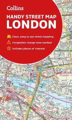
Clear and easy-to-read map of central London and surrounding area. Contains detailed mapping, presented in a handy compact format. This attractive map, ideal for both tourists and residents, and fully updated, has an extensive area of coverage and displays a wealth of detail. This map includes electric car recharging sites, fully classified roads, congestion charging zone & T-charge (Ultra Low Emission Zone from April 2019), postal districts and boundaries clearly depicted, full indexes to street names (on back of map), place names and places of interest, fully updated London underground map conveniently located on the back cover. Extends from Hampstead in the north to Clapham in the south and from Hammersmith in the west to Greenwich in the east. Scale: 1:17,500 (3.6 inches to 1 mile).
Spécifications
Parties prenantes
- Auteur(s) :
- Editeur:
Contenu
- Nombre de pages :
- 2
- Langue:
- Anglais
Caractéristiques
- EAN:
- 9780008320584
- Date de parution :
- 01-09-19
- Format:
- Carte pliée
- Dimensions :
- 109 mm x 188 mm
- Poids :
- 90 g


Les avis
Nous publions uniquement les avis qui respectent les conditions requises. Consultez nos conditions pour les avis.