
- Retrait gratuit dans votre magasin Club
- 7.000.000 titres dans notre catalogue
- Payer en toute sécurité
- Toujours un magasin près de chez vous
- Retrait gratuit dans votre magasin Club
- 7.000.0000 titres dans notre catalogue
- Payer en toute sécurité
- Toujours un magasin près de chez vous


15,45 €
+ 30 points
Description
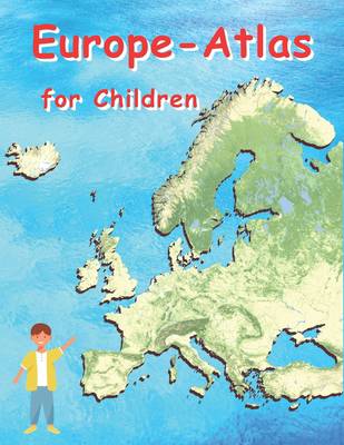
Europe Atlas for Children: Geographical Atlas for Children European Countries
The Geographical Atlas of Europe is aimed equally at teachers, schoolchildren, students and generally anyone with a passion for geography. This atlas is colorful and features maps or pictures to help keep children interested in learning. It is a work of general culture that no library should be without. The workbook for the atlas can also be found on Amazon under the title: Atlas of European Countries Workbook for Children with ISBN: 979-8825172569
- 59 different maps
- 75 pages
- Colored
- A4 format, large print 21.59 cm x 27.94 cm (8.5" x 11")
The Geographical Atlas of Europe is aimed equally at teachers, schoolchildren, students and generally anyone with a passion for geography. This atlas is colorful and features maps or pictures to help keep children interested in learning. It is a work of general culture that no library should be without. The workbook for the atlas can also be found on Amazon under the title: Atlas of European Countries Workbook for Children with ISBN: 979-8825172569
Spécifications
Parties prenantes
- Auteur(s) :
- Editeur:
Contenu
- Nombre de pages :
- 76
- Langue:
- Anglais
- Collection :
Caractéristiques
- EAN:
- 9798825163918
- Date de parution :
- 12-05-22
- Format:
- Livre broché
- Format numérique:
- Trade paperback (VS)
- Dimensions :
- 216 mm x 279 mm
- Poids :
- 199 g


Les avis
Nous publions uniquement les avis qui respectent les conditions requises. Consultez nos conditions pour les avis.