
- Retrait gratuit dans votre magasin Club
- 7.000.000 titres dans notre catalogue
- Payer en toute sécurité
- Toujours un magasin près de chez vous
- Retrait gratuit dans votre magasin Club
- 7.000.0000 titres dans notre catalogue
- Payer en toute sécurité
- Toujours un magasin près de chez vous


Description
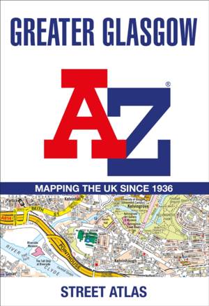
Navigate your way in and around Glasgow with this detailed and easy-to-use A-Z Street Atlas.
Printed in full-colour, paperback format, this A4 atlas contains 168 pages of continuous street mapping. More than 23,000 streets indexed.
The main mapping extends well beyond central Glasgow at a scale of 5.4 inches to 1 mile, featuring postcode districts, one-way streets and park and ride sites.
Areas covered include Hamilton, Motherwell, Paisley, Clydebank, Coatbridge, Airdrie, Renfrew, Kirkintilloch, Dumbarton, Milngavie, Cumbernauld, Johnstone, Barrhead, East Kilbride, Larkhall, Carluke.
The large-scale street map of Glasgow city centre is at a scale of 10.82 inches to 1 mile.
The atlas also includes:
- Postcode map of the Glasgow area
- Road map of the Glasgow area
- Diagrammatic map of rail and subway connections
A comprehensive index lists streets, places & areas, industrial estates, selected flats & walkways, junction names & service areas, stations and selected places of interest.
Spécifications
Parties prenantes
- Auteur(s) :
- Editeur:
Contenu
- Nombre de pages :
- 288
- Langue:
- Anglais
Caractéristiques
- EAN:
- 9780008560430
- Date de parution :
- 30-05-23
- Format:
- Livre broché
- Format numérique:
- Trade paperback (VS)
- Dimensions :
- 202 mm x 297 mm
- Poids :
- 818 g

Les avis
Nous publions uniquement les avis qui respectent les conditions requises. Consultez nos conditions pour les avis.