
- Retrait gratuit dans votre magasin Club
- 7.000.000 titres dans notre catalogue
- Payer en toute sécurité
- Toujours un magasin près de chez vous
- Retrait gratuit dans votre magasin Club
- 7.000.0000 titres dans notre catalogue
- Payer en toute sécurité
- Toujours un magasin près de chez vous


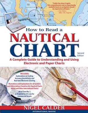
How to Read a Nautical Chart, 2nd Edition (Includes All of Chart #1)
A Complete Guide to Using and Understanding Electronic and Paper Charts
Nigel Calder
Livre broché | Anglais
36,45 €
+ 72 points
Description
Authoritative, practical, and hands-on information on reading and relying on electronic and paper nautical charts
The classic How to Read a Nautical Chart explains every aspect of electronic and paper nautical charts: how a chart is assembled, how to gauge the accuracy of chart data, how to read charts created by other governments, how to use information such as scale, projection technique and datum that every chart contains; how not to get fooled or run aground by overzooming. Nigel Calder teaches you how to squeeze every ounce of information out of a nautical chart (on your GPS, chartplotter, or nav station) and understand the limits of accuracy for all charts, paper and electronic, raster and vector.
This much-awaited second edition addresses the changes in the world of electronic charting, integrated onboard navigation systems, as well as radar overlays and AIS and their interfacing with charts. A new chapter onthe Wiki Revolution explores the mechanisms allowing you to incorporate user-generated content into navigational products and share this content with others--harnessing a user-base never before possible. Calder also explores how 3D-technology and real-time depth and weather information is creating interactive charting capacities that are fundamentally changing how we navigate. Calder's unique, practical insights will help you to navigate safely for years to come.Spécifications
Parties prenantes
- Auteur(s) :
- Editeur:
Contenu
- Nombre de pages :
- 272
- Langue:
- Anglais
Caractéristiques
- EAN:
- 9780071779821
- Date de parution :
- 08-03-12
- Format:
- Livre broché
- Format numérique:
- Trade paperback (VS)
- Dimensions :
- 213 mm x 272 mm
- Poids :
- 589 g

Les avis
Nous publions uniquement les avis qui respectent les conditions requises. Consultez nos conditions pour les avis.