Vous voulez être sûr que vos cadeaux seront sous le sapin de Noël à temps? Nos magasins vous accueillent à bras ouverts. La plupart de nos magasins sont ouverts également les dimanches, vous pouvez vérifier les heures d'ouvertures sur notre site.
  •  Retrait gratuit dans votre magasin Club
  •  7.000.000 titres dans notre catalogue
  •  Payer en toute sécurité
  •  Toujours un magasin près de chez vous     
Vous voulez être sûr que vos cadeaux seront sous le sapin de Noël à temps? Nos magasins vous accueillent à bras ouverts. La plupart de nos magasins sont ouverts également les dimanches, vous pouvez vérifier les heures d'ouvertures sur notre site.
  •  Retrait gratuit dans votre magasin Club
  •  7.000.0000 titres dans notre catalogue
  •  Payer en toute sécurité
  •  Toujours un magasin près de chez vous
  1. Accueil
  2. Livres
  3. Sciences humaines
  4. Sciences
  5. Sciences de la terre
  6. Géographie
  7. Imaging from Spaceborne and Airborne Sars, Calibration, and Applications

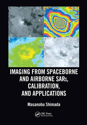
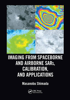
Imaging from Spaceborne and Airborne Sars, Calibration, and Applications

Masanobu Shimada
Livre broché | Anglais | Sar Remote Sensing
94,95 €
+ 189 points
Livraison 2 à 3 semaines
Passer une commande en un clic
Payer en toute sécurité
Livraison en Belgique: 3,99 €
Livraison en magasin gratuite

Description

Sixty years after its birth, Synthetic Aperture Radar (SAR) evolved as a key player of earth observation, and it is continually upgraded by enhanced hardware functionality and improved overall performance in response to user requirements. The basic information gained by SAR includes the backscattering coefficient of targets, their phases (the truncated distance between SAR and its targets), and their polarization dependence. The spatiotemporal combination of the multiple data operated on the satellite or aircraft significantly increases its sensitivity to detect changes on earth, including temporal variations of the planet in amplitude and the interferometric change for monitoring disasters; deformations caused by earthquakes, volcanic activity, and landslides; environmental changes; ship detection; and so on. Earth-orbiting satellites with the appropriate sensors can detect environmental changes because of their large spatial coverage and availability.

Imaging from Spaceborne and Airborne SARs, Calibration, and Applications provides A-to-Z information regarding SAR researches through 15 chapters that focus on the JAXA L-band SAR, including hardware description, principles of SAR imaging, theoretical description of SAR imaging and error, ScanSAR imaging, polarimetric calibration, inflight antenna pattern, SAR geometry and ortho rectification, SAR calibration, defocusing for moving targets, large-scale SAR imaging and mosaic, interferometric SAR processing, irregularities, application, and forest estimation. Sample data are created by using L-band SAR, JERS-1, PALSAR, PALSAR-2, and Pi-SAR-L2.

This book is based on the author's experience as a principal researcher at JAXA with responsibilities for L-band SAR operation and researches. It reveals the inside of SAR processing and application researches performed at JAXA, which makes this book a valuable reference for a wide range of SAR researchers, professionals, and students.

Spécifications

Parties prenantes

Auteur(s) :
Editeur:

Contenu

Nombre de pages :
392
Langue:
Anglais
Collection :

Caractéristiques

EAN:
9780367570798
Date de parution :
30-06-20
Format:
Livre broché
Format numérique:
Trade paperback (VS)
Dimensions :
178 mm x 254 mm
Poids :
675 g

Les avis