- Retrait gratuit dans votre magasin Club
- 7.000.000 titres dans notre catalogue
- Payer en toute sécurité
- Toujours un magasin près de chez vous
- Retrait gratuit dans votre magasin Club
- 7.000.0000 titres dans notre catalogue
- Payer en toute sécurité
- Toujours un magasin près de chez vous
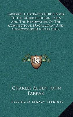
Farrar's Illustrated Guide Book To The Androscoggin Lakes And The Headwaters Of The Connecticut, Magalloway, And Androscoggin Rivers (1887)
Charles Alden John Farrar
Livre relié | Anglais
67,95 €
+ 135 points
Description
Farrar�������s Illustrated Guide Book To The Androscoggin Lakes And The Headwaters Of The Connecticut, Magalloway, And Androscoggin Rivers (1887) is a guidebook written by Charles Alden John Farrar. The book is a comprehensive guide to the Androscoggin Lakes and the headwaters of the Connecticut, Magalloway, and Androscoggin Rivers, located in the northeastern United States. The guidebook provides detailed information on the geography, history, and natural features of the region, including descriptions of the lakes, rivers, forests, and mountains. It also includes information on the flora and fauna of the area, as well as advice on fishing, hunting, camping, and hiking. The book is illustrated with numerous maps, photographs, and drawings, providing readers with a visual representation of the landscape and its features.Farrar�������s Illustrated Guide Book To The Androscoggin Lakes And The Headwaters Of The Connecticut, Magalloway, And Androscoggin Rivers is a valuable resource for anyone interested in exploring the natural beauty of this region, whether for recreational purposes or for scientific study. The book provides a wealth of information on the area�������s history, geography, and natural features, making it an indispensable guide for anyone looking to explore this part of the United States.Dixville Notch, Grafton Notch, And Andover, Maine And Vicinity. With A New And Correct Map Of The Lake Region, Drawn And Printed Expressly For This Book. Also, Contains A Valuable Treatise On Camping Out, And The Game And Fish Laws Of Maine And New Hampshire, As Revised By The Last Legislatures. Railroad, Steamboat, And Stage Routes, Time Tables, Table Of Fares, List Of Hotels, Prices Of Board, And Other Valuable Information For The Sportsman, Tourist, Or Pleasure Seeker.This scarce antiquarian book is a facsimile reprint of the old original and may contain some imperfections such as library marks and notations. Because we believe this work is culturally important, we have made it available as part of our commitment for protecting, preserving, and promoting the world's literature in affordable, high quality, modern editions, that are true to their original work.
Spécifications
Parties prenantes
- Auteur(s) :
- Editeur:
Contenu
- Nombre de pages :
- 370
- Langue:
- Anglais
Caractéristiques
- EAN:
- 9781165041275
- Date de parution :
- 10-09-10
- Format:
- Livre relié
- Format numérique:
- Genaaid
- Dimensions :
- 152 mm x 229 mm
- Poids :
- 712 g

Les avis
Nous publions uniquement les avis qui respectent les conditions requises. Consultez nos conditions pour les avis.


