
- Retrait gratuit dans votre magasin Club
- 7.000.000 titres dans notre catalogue
- Payer en toute sécurité
- Toujours un magasin près de chez vous
- Retrait gratuit dans votre magasin Club
- 7.000.0000 titres dans notre catalogue
- Payer en toute sécurité
- Toujours un magasin près de chez vous


Description
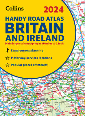
This easy-to-use, handy A5 sized road atlas with popular lie-flat spiral binding features extremely clear route planning maps of Britain and Ireland and fits neatly into your glove box or bag. The atlas has been fully updated. The maps of Britain are at 9.9 miles to 1 inch (1:625,000) and the whole of Ireland is covered at 15.8 miles to 1 inch (1:1,000,000). There are also a selection of more detailed urban area maps at 4.5 miles to 1 inch (1:285,000) to aid route planning in these busy areas. Main features
- Road maps that focus on the main roads, motorways and settlements.
- More detailed maps of London, Manchester, Merseyside and West Midlands.
- Park & Ride locations (for bus and rail).
- Handy distance calculator chart highlighting distances between the major towns.
Spécifications
Parties prenantes
- Auteur(s) :
- Editeur:
Contenu
- Nombre de pages :
- 80
- Langue:
- Anglais
- Collection :
Caractéristiques
- EAN:
- 9780008597610
- Date de parution :
- 16-08-23
- Format:
- Reliure spiralée
- Dimensions :
- 154 mm x 210 mm
- Poids :
- 136 g

Les avis
Nous publions uniquement les avis qui respectent les conditions requises. Consultez nos conditions pour les avis.