
- Retrait gratuit dans votre magasin Club
- 7.000.000 titres dans notre catalogue
- Payer en toute sécurité
- Toujours un magasin près de chez vous
- Retrait gratuit dans votre magasin Club
- 7.000.0000 titres dans notre catalogue
- Payer en toute sécurité
- Toujours un magasin près de chez vous


Description
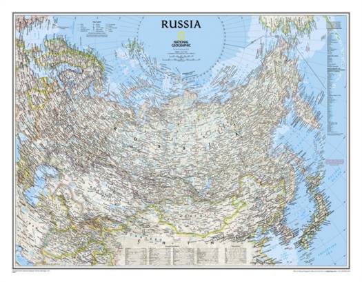
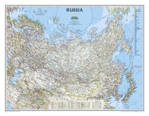
National Geographic's political map of Russia and the independent states of the former Soviet Union is one of the most authoritative maps of region. This Classic style wall map features a bright color palette with blue oceans and the country's terrain detailed in stunning shaded relief that has been a hallmark of National Geographic maps for over 75 years. Thousands of place names, accurate political boundaries, bodies of water, and major infrastructure networks such as roadways, airports, canals, oil pipelines, and railroads are detailed. Coastal bathymetry is shown with depth curves and soundings, and the boundaries of Northern Sea shipping routes are marked as well. Coverage also includes Norway, Sweden, Finland, Denmark, Latvia, Lithuania, Estonia, Ukraine, Belarus, Georgia, Armenia, Azerbaijan, Turkmenistan, Uzbekistan, Kazakhstan, Kyrgyzstan, Tajikistan, Afghanistan, Mongolia, North Korea, South Korea, and Japan, as well as portions of Germany, Poland, Iran, Pakistan, and China.
The map is packaged in a two inch diameter tube with a label showing a thumbnail of the map with dimensions and other pertinent information.
- Map Scale = 1:12,376,000
- Sheet Size = 30.25" x 23.5"
Spécifications
Parties prenantes
- Auteur(s) :
- Editeur:
Contenu
- Nombre de pages :
- 1
- Langue:
- Anglais
- Collection :
Caractéristiques
- EAN:
- 9780792249832
- Date de parution :
- 21-11-16
- Format:
- Carte roulée
- Dimensions :
- 77 cm x 60 cm
- Poids :
- 54 g

Les avis
Nous publions uniquement les avis qui respectent les conditions requises. Consultez nos conditions pour les avis.