
- Retrait gratuit dans votre magasin Club
- 7.000.000 titres dans notre catalogue
- Payer en toute sécurité
- Toujours un magasin près de chez vous
- Retrait gratuit dans votre magasin Club
- 7.000.0000 titres dans notre catalogue
- Payer en toute sécurité
- Toujours un magasin près de chez vous


Description
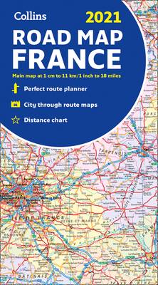
New edition of annually revised, politically coloured road map of France at 18 miles to 1 inch / 11km to 1cm (1:1,120,000). The map shows individual department by name, and cities, towns, roads, European route numbers, motorways and toll motorways are clearly shown, making it the ideal map for planning and route-finding.
The map shows the road network in detail for easy route planning. With its political colouring of departments, it is ideal for reference and business users also.
Main features
- Fully revised and updated
- Clear, detailed road network
- Through-route maps of Paris, Lyon, Marseille, Strasbourg, and Toulouse
- Distance chart giving distances in kilometres between main towns
- Key to department names and numbers, and list of regions
- Internet links to further information
- Full Index to place names
- Map key in English, French and German
Area of coverage
Covers the whole of France from the Belgian and German borders in the north to the Spanish border in the south, and from the Brest Peninsula in the west to the Italian and Swiss borders in the east. Also includes the island of Corsica.
Spécifications
Parties prenantes
- Auteur(s) :
- Editeur:
Contenu
- Nombre de pages :
- 2
- Langue:
- Anglais
- Collection :
Caractéristiques
- EAN:
- 9780008374358
- Date de parution :
- 15-08-20
- Format:
- Carte pliée
- Dimensions :
- 135 mm x 249 mm
- Poids :
- 136 g

Les avis
Nous publions uniquement les avis qui respectent les conditions requises. Consultez nos conditions pour les avis.