
- Retrait gratuit dans votre magasin Club
- 7.000.000 titres dans notre catalogue
- Payer en toute sécurité
- Toujours un magasin près de chez vous
- Retrait gratuit dans votre magasin Club
- 7.000.0000 titres dans notre catalogue
- Payer en toute sécurité
- Toujours un magasin près de chez vous


Description
- Waterproof - Tear-Resistant - Topographic Maps
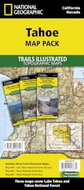
Lake Tahoe is the sapphire jewel in the crown of the Sierra Nevada mountains. The lake's surface covers almost 200 square miles and forms part of the border between California and Nevada. Just to the north of recreation meca of Lake Tahoe is Tahoe National Forest with nearly 900,000 acres of recreational opportunities. Rivers, snow capped peaks and dense forests offer outstanding recreation year round. In this section of the Sierras a complex set of ecosystems are found as the terrain ascends from 1,500 feet along the western boundary to over 9,000 feet along the crest.
The Tahoe Map Pack includes:
- Map 803:: Lake Tahoe Basin
- Map 804:: Tahoe National Forest West
- Map 805:: Tahoe Naitonal Forest East
Every Trails Illustrated map is printed on "Backcountry Tough" waterproof, tear-resistant paper. A full UTM grid is printed on the map to aid with GPS navigation.
- Map Scale = 1:63,360
- Sheet Size = 25.5" x 37.75"
- Folded Size = 4.25" x 9.25"
Spécifications
Parties prenantes
- Auteur(s) :
- Editeur:
Contenu
- Nombre de pages :
- 6
- Langue:
- Anglais
- Collection :
Caractéristiques
- EAN:
- 9781566957427
- Date de parution :
- 01-01-23
- Format:
- Carte pliée
- Dimensions :
- 117 mm x 239 mm
- Poids :
- 294 g


Les avis
Nous publions uniquement les avis qui respectent les conditions requises. Consultez nos conditions pour les avis.